Build Trust in Every Survey You Deliver

From field data to verified plans and branded invoices, Geoflow helps surveyors work faster, prove authenticity, and impress clients.

Dashboard Screenshot
img
24/7 Support
img
3+ Subscription Plans
img
10+ Clients
img

Who We Are

Empowering surveyors with the tools they actually need.

  • Built by geomatics professionals who live your daily reality.
  • We’ve experienced firsthand the manual delays, paperwork fatigue, and rework caused by outdated systems.
  • GeoFlow was created to automate and simplify the surveying process without removing professional control.
  • Our mission is to make your surveying workflow faster, more accurate, and client-friendly.
  • We understand the everyday challenges of fieldwork and plan documentation.

What Drives Us

We believe your work should speak for you, professionally, securely, and credibly.

  • Eliminate paper clutter, lost plans, and verification delays.
  • Protect your name by issuing every job with a scannable QR code.
  • Brand yourself with beautiful, custom invoices and job sheets.
  • Fight quack surveyors, clients can verify jobs and surveyor identity instantly.
  • Raise the standard: GeoFlow helps professionals shine.
img

What Our Software Offers

Our software provides powerful, scalable solutions designed to streamline your business operations.

img

Job Registration & Tracking

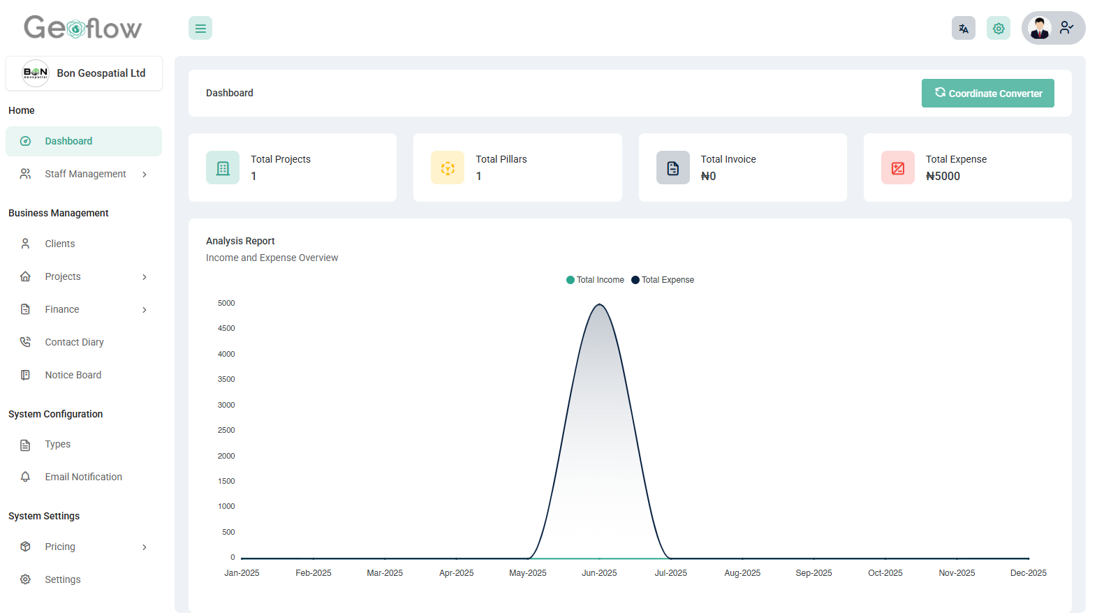
Register new jobs, assign team members, and track progress all in one place.

img

QR Code Plan Verification

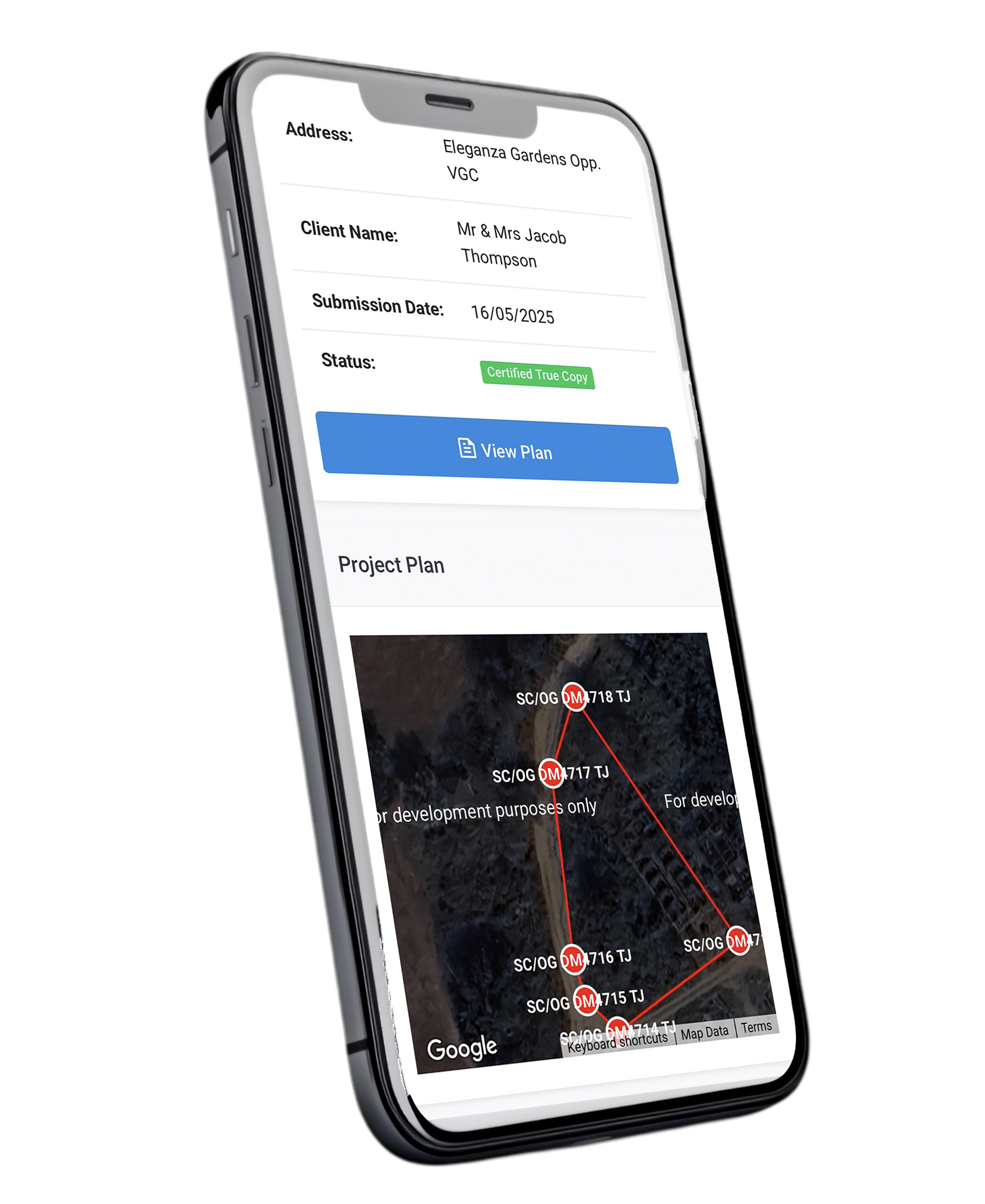
Every plan or job output comes with a scannable QR code for instant online verification.

img

Pillar Plotting & Visualization

Plot coordinates with satellite map overlays, visualize your work geographically.

img

Auto-Generate Record Copy Traverse

Automatically generate Traverse from your referenced controls to your site in one click.

img

Custom Invoice Generator

Generate branded invoices in seconds — PDF-ready and client-friendly.

img

Expense Management

Track project expenses and logistics costs in real-time for better planning.

Tools That Elevate Your Practice

Beyond automation, Geoflow helps you stand out, organize better, present smarter, and earn more client trust.

img

Centralized Project Management

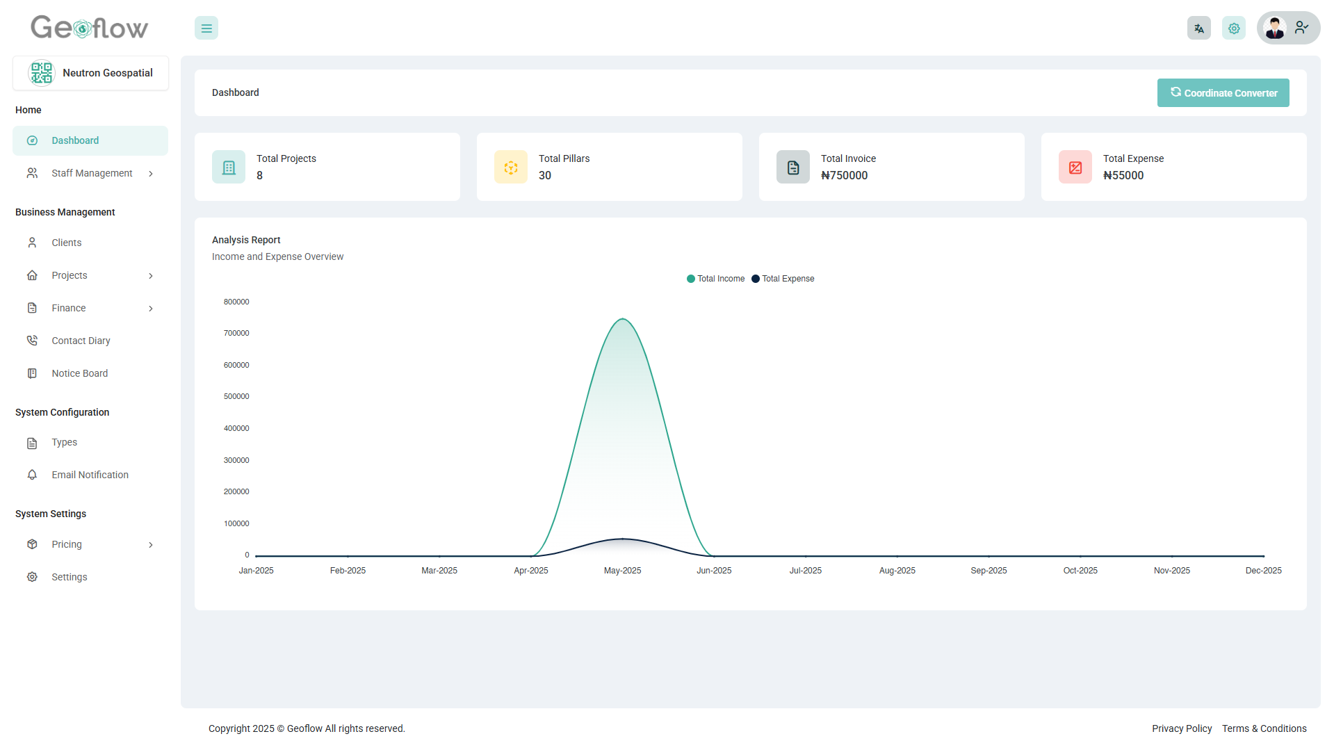
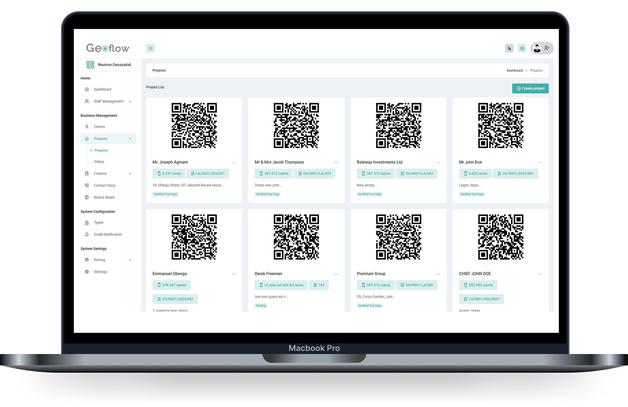
Manage all your surveying projects in one unified workspace. Create, organize, and track project data with ease, from site details to client information, ensuring nothing gets lost or overlooked.

img

QR Code Plan Verification

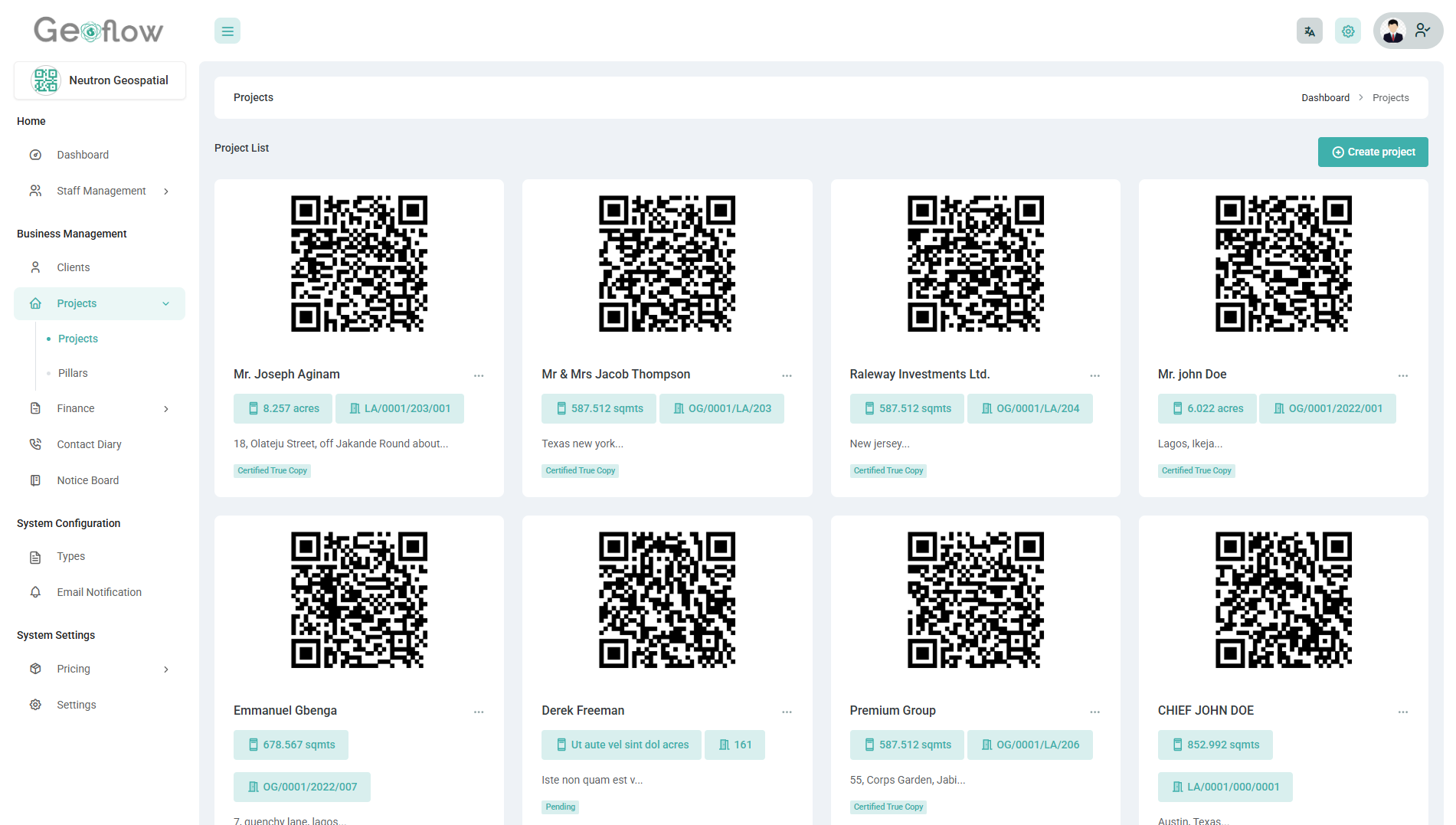
Generate secure QR codes for every survey plan, enabling instant verification. Clients and stakeholders can scan to view project details, boosting trust, transparency, and authenticity.

img

Custom Invoice & Financial Tracking

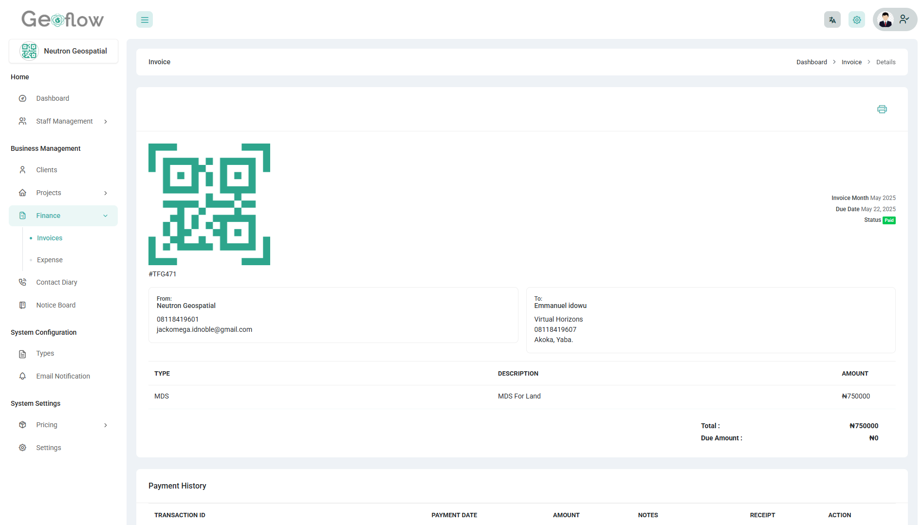
Generate professional invoices tailored to your brand and track payments effortlessly. Stay on top of your finances with clear visibility into revenue and expenses.

img

Coordinate Plotting & Boundary Visualization

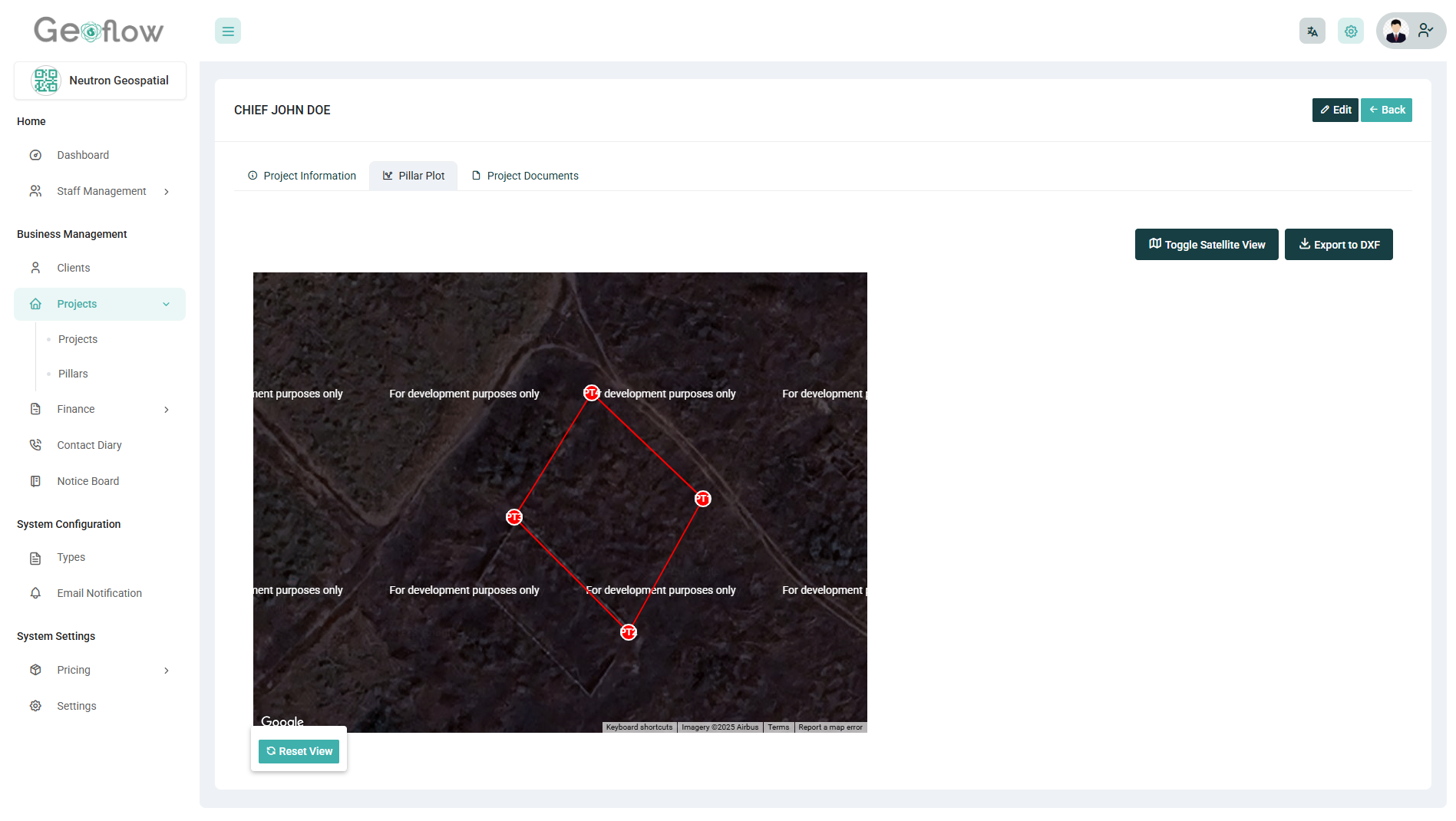
Plot survey points using angles and distances with precision, and instantly visualize boundaries on an interactive satellite map. Accurately define land parcels, validate layouts, and reduce errors before field execution.

img

Coordinate Entry & Pillar Return System

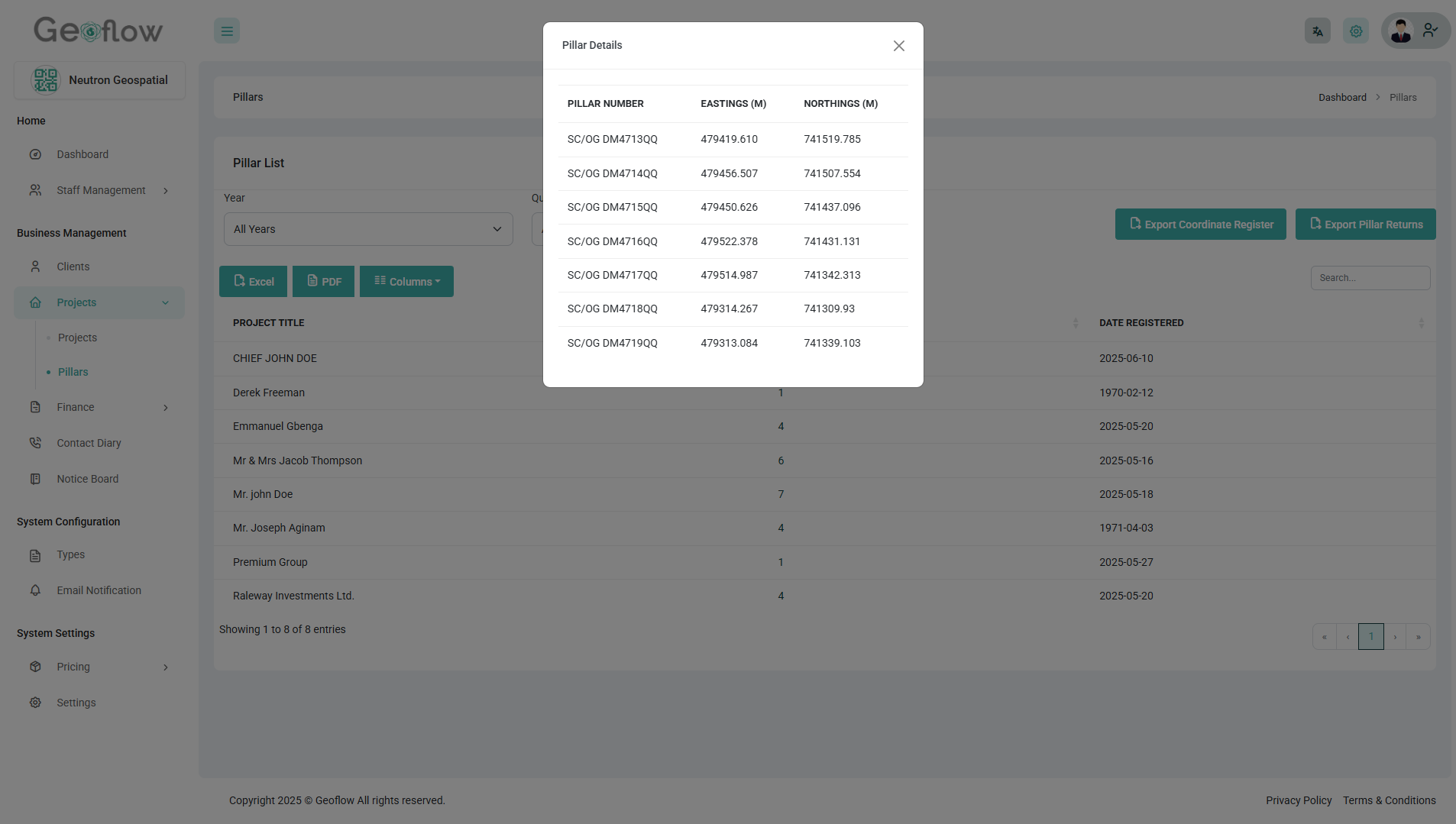
Easily register coordinates from the field and use the pillar return system to generate standardized plans with calculated bearings, distances, and annotations, fast, consistent, and export-ready.

img

Satellite-Based Project Visualization

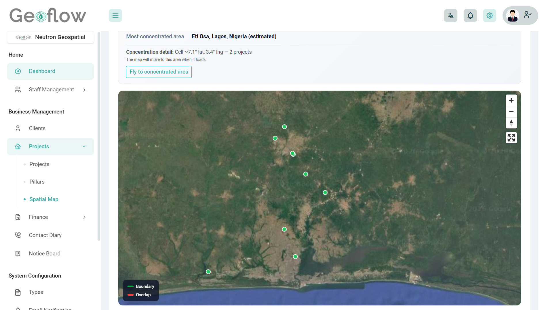
View all your projects on an interactive satellite map. Instantly identify project locations, detect overlaps, and gain spatial insights that improve planning accuracy and decision-making.

img

Record Copy Traverse Generation

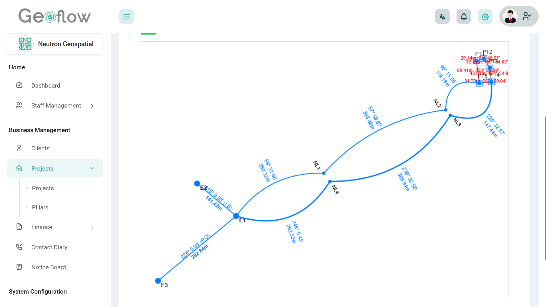
Generate record copy traverse to and from referenced control points at the click of a button, export to dxf and fix on your personal template as needed

Why Surveyors Trust GeoFlow

Smart tools. Verified trust. A professional edge for the modern surveyor.

Built by local geomatics engineers

Branded client outputs

Helps eliminate fake/unauthorized jobs

Verifiable job portal

Active customer support

Security You Can Trust

User-Friendly Interface

Innovation at Its Core

Frequently Asked Questions (FAQ)

Still have questions? Here are some quick answers to help you understand how GeoFlow works and why it’s the right tool for your surveying business.

You’ll still have access to your data, but most features will be locked. You can reactivate your plan at any time to restore full access.

Clients can scan QR codes to instantly verify that a job was executed by the registered surveyor they commissioned. Only verified professionals, those who have undergone thorough background checks and license validation, are authorized to use Geoflow to generate public-facing records. Our KYC process ensures that every professional on our platform is trustworthy, helping us maintain client confidence and uphold the integrity of Geoflow.

Yes, Geoflow is designed exclusively for professionals with valid surveying credentials. We verify that every company on the platform is owned or managed by a licensed surveyor in order to maintain integrity. However, companies may create additional user accounts for non-licensed team members (such as drafters or field assistants). These users operate under the company's profile and represent the licensed entity in all activities.

Each job or plan you register is assigned a unique QR code. When scanned by a client or authority, it links to a secure GeoFlow page showing a summary of the job and verification details, instantly proving its authenticity.

Yes. With the Premium plans, you can add multiple users to your account and assign roles (e.g., field staff, office staff, drafters) with controlled access to specific sections.

Geoflow is built for licensed Nigerian surveyors and surveying firms. Whether you’re a solo practitioner or manage a team, the platform adapts to your needs.

We offer email support, and dedicated account managers for Firm plans. Our support team understands surveying and can guide you through setup or issues quickly.

GeoFlow uses secure cloud infrastructure with role-based access, encrypted storage, and internal review protocols. Only verified surveyors are allowed to issue jobs through the system.

Yes, you can manually upload past jobs to your dashboard. Pro users and firms can request assistance for bulk data import or structured migration.

Absolutely. Geoflow allows you to upload your logo, add your firm’s name, and generate custom invoices, job sheets, and downloadable PDFs that carry your brand identity.